Complete Solutions and Summary of Lifelines of National Economy – NCERT Class 10, Geography, Chapter 7 – Summary, Questions, Answers, Extra Questions
Detailed summary and explanation of Chapter 7 'Lifelines of National Economy' covering means of transport (roadways, railways, waterways, airways, pipelines), communication systems, trade, international trade, tourism as a trade, and their importance in economic development with all question answers, activities, and extra questions from NCERT Class X Geography.
Updated: 9 months ago
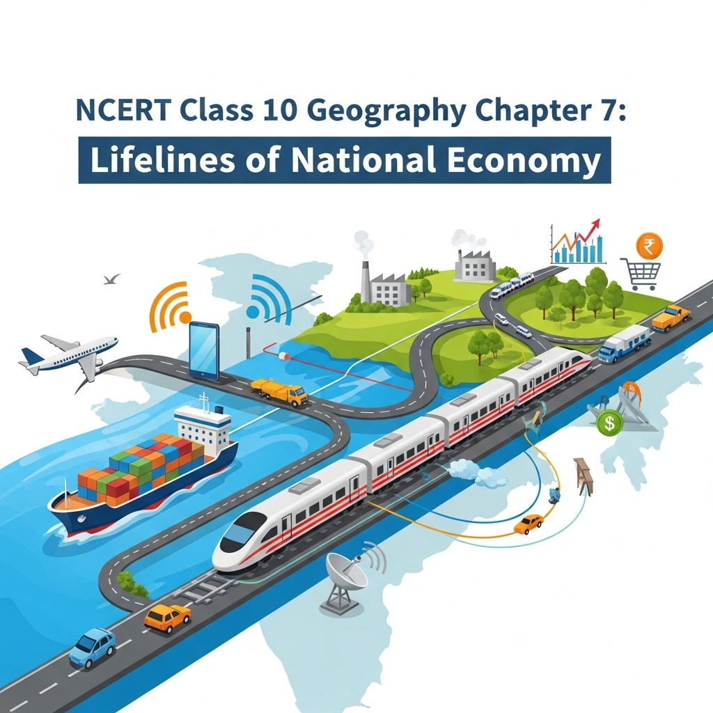
Lifelines of National Economy
Chapter 7: Geography - Complete Study Guide | NCERT Class 10 Notes & Questions 2025
Comprehensive Chapter Summary - Lifelines of National Economy Class 10 NCERT
Overview
- Chapter Purpose: Explains how transport and communication serve as lifelines for economy by moving goods/services. Materials/services from surroundings or distant places need transport/traders. Development pace depends on production and movement. Domains: Land, water, air. Trade/transport expanded with science/technology, turning world into village. Communication complements transport. India linked globally despite diversity via railways, airways, etc., boosting socio-economic progress, trade, amenities. Fig. 7.1: Means of Transport. Key Insight: Dense efficient network prerequisite for trade. Reprint 2025-26 updates stats like roads 62.16 lakh km (2020-21).
- Expanded Relevance 2025: Focus on infrastructure growth, digital communication, sustainable tourism amid globalization. Update: Schemes like UDAN, Digital India.
- Exam Tip: Classify transport modes; use maps for NH, railways; know problems like rail thefts, pollution.
- Broader Implications: Facilitate economic integration, reduce distances, support industry/agriculture; challenges like uneven distribution, environmental impacts.
Transport
- Roadways: India's second largest network (62.16 lakh km, 2020-21), preceded railways, edge in ease of build/maintenance. Importance: Lower construction cost, traverse dissected/undulating topography, higher gradients (Himalayas), economical for short distances/few persons/goods, door-to-door, feeder to other modes. Classification: Golden Quadrilateral (Delhi-Kolkata-Chennai-Mumbai-Delhi, 6-lane by NHAI, reduce time/distance); National Highways (extreme parts, N-S/E-W); State Highways (capital to districts); District Roads; Other Roads (rural, PMGSY for all-weather links); Border Roads (BRO 1960, strategic N/NE borders). Metalled (all-weather) vs Unmetalled (rainy unusable). Fig. 7.2: Ahmedabad-Vadodara Expressway. Activity: NH numbers from morth.nic.in; Sher-Shah Suri Marg (Delhi-Amritsar) is NH-1.
- Railways: Principal for freight/passengers, enable business/sightseeing/pilgrimage/goods over long distances, integrating force >150 years, bind economy, accelerate industry/agriculture. Largest public undertaking; first train Mumbai-Thane 1853 (34 km). Reorganized into 17 zones. Distribution: Influenced by physiographic (plains favorable, hills/tunnels/gaps, Himalayas unfavorable), economic (dense population/rich resources), administrative. Problems: Ticketless travel, thefts/damage, chain-pulling/delays. Fig. 7.3: Hilly Tracts; Fig. 7.4: Traffic NE Border (Arunachal). Activity: Zones/HQs on map. Do You Know: Atal Tunnel (9.02 km, BRO, connects Manali-Lahul-Spiti, ultra-modern, 3000m MSL).
- Pipelines: New on map, transport crude/petroleum/natural gas/slurry solids. Inland refineries (Barauni, Mathura, Panipat) possible; high initial cost, minimal running/trans-shipment losses/delays. Networks: Upper Assam-Kanpur (branches Barauni-Haldia, Guwahati-Siliguri); Salaya-Jalandhar (branches Koyali); HVJ (1700 km, Mumbai High/Bassein to W/N India, expanded to 18,500 km).
- Waterways: Cheapest for heavy/bulky, fuel-efficient, eco-friendly. India seafaring anciently; 14,500 km inland, 111 NWs (2016 Act, incl. 5 earlier). Key NWs: Ganga (Prayagraj-Haldia, NW-1, 1620 km); Brahmaputra (Sadiya-Dhubri, NW-2, 891 km); West-Coast Canal Kerala (NW-3, 205 km); Godavari/Krishna canals (NW-4, 1078 km); Brahmani/Mahanadi/East Coast (NW-5, 588 km). Others: Mandavi, Zuari, Cumberjua, Sunderbans, Barak, Kerala backwaters. Sea trade: 95% volume (68% value). Fig. 7.5: Inland Waterways NE States.
- Major Sea Ports: 7516.6 km coastline, 12 major/200 minor ports; 95% foreign trade. Deendayal (Kandla, tidal, post-Partition relief Mumbai, handles granary/industrial belt J&K/HP/Punjab/Haryana/Rajasthan/Gujarat). Mumbai (biggest, natural harbor); Jawaharlal Nehru (decongest Mumbai); Mormugao (Goa, 50% iron ore export); New Mangalore (Karnataka, Kudremukh iron); Cochin (SW, lagoon entrance); V.O. Chidambaranar (Tuticorin, TN, natural harbor, rich hinterland, trade neighbors/coastal). Chennai (oldest artificial); Visakhapatnam (deepest landlocked, iron outlet); Paradwip (Odisha, iron); Shyama Prasad Mookerjee (Kolkata, inland riverine, Hooghly dredging); Haldia (relieve Kolkata). Fig. 7.6: Trucks into Vessel Mumbai; Fig. 7.7: Tanker New Mangalore; Fig. 7.8: Oversize Cargo Tuticorin.
- Airways: Fastest, comfortable, prestigious; covers difficult terrains (mountains, deserts, oceans). Preferred NE states (big rivers, dissected relief, forests, floods, frontiers). Pawanhans Helicopters: ONGC offshore, inaccessible (NE, J&K interior, HP, Uttarakhand). Do You Know: UDAN (Ude Desh ka Aam Nagrik, MoCA) - regional connectivity, affordable flying. Fig. 7.9: Air Travel NE States.
Communication
- Overview: Rapid change modern times; easier long-distance without movement. Personal (letters) and mass (TV, radio, press, films). Indian postal largest world, handles parcels/letters. First-class (cards/envelopes, airlifted); Second-class (books, newspapers, surface). Channels: Rajdhani, Metro, Green, Business, Bulk Mail, Periodical. Telecom: Largest Asia, >2/3 villages STD; uniform rates via space/communication tech. Do You Know: Digital India - umbrella for knowledge transformation, IT+IT=IT (India Tomorrow). Mass: Entertainment/awareness; All India Radio (Akashvani) national/regional/local; Doordarshan national TV; newspapers (Hindi most, then English/Urdu); films (largest producer, short/video; Central Board Film Certification). Fig. 7.10: Emergency Call Box NH-48.
International Trade
- Overview: Exchange goods/states/countries; market place; between countries international. Local (cities/towns/villages), state-level. Advancement index prosperity, economic barometer. Resources space-bound, no survival without. Export/import components; favorable (export>import), unfavorable (import>export). India relations all blocks/regions. Exports: Gems/jewellery, chemicals, agriculture. Imports: Petroleum, gems/jewellery, chemicals, metals, electronics, machinery, agriculture.
Tourism as a Trade
- Overview: Grown remarkably past two decades via initiatives, infrastructure, branding. Schemes: Swadesh Darshan 2.0, Vibrant Village, PRASHAD, Paryatan Mitra. Promotes integration, supports handicrafts/culture, international understanding. Types: Heritage, eco, adventure, cultural, medical, business. Vast potential all parts; promote types for industry. Activity: Project heritage tourism India; map state tourist places/connectivity; discuss types/development/help economic sustainable.
SEO Note: Why This Guide?
Top-ranked for 'Lifelines of National Economy Class 10 notes 2025'—free, with 60 Q&A from PDF, quizzes. Integrates economic insights.
Key Themes
- Transport Modes: Land (road/rail/pipeline), Water (inland/overseas), Air (domestic/international).
- Details: Classifications, networks, problems, figures/maps.
- Communication/Trade Links: Complements transport; barometer prosperity.
- Critical Thinking: Why roadways edge? Rail problems solutions? Tourism potential?
Cases for Exams
Use maps for ports/NH; discuss BRO strategic role; analyze trade balance.
Exercises Summary
- Focus: Expanded to 60 Q&A from PDF: 20 short (2M), 20 medium (4M), 20 long (8M) based on NCERT exercises + similar.
- Project Idea: Crossword for terms; map marking ports, airports.


As an Amazon Associate, ProSyllabus earns from qualifying purchases. Prices shown are subject to change.
Test your CBSE Class 10 Board Examination prep
Quizzes
10 questions · ~10 minutes · instant rank & AI diagnosis
Class 10 English — Nelson Mandela: Long Walk to Freedom (Practice Quiz)
Chemical Reactions and Equations Fundamentals — Free CBSE Class 10 Board Examination Quiz
Class 10 English — A Triumph of Surgery (Practice Quiz)
Class 10 English — A Letter to God (Practice Quiz)
Reading Comprehension Passages Fundamentals | CBSE Class 10 Board Examination
कक्षा 10 संस्कृत — रचना-प्रयोगः (अभ्यास प्रश्नोत्तरी)
कक्षा 10 संस्कृत — वाच्य-परिवर्तनम् (अभ्यास प्रश्नोत्तरी)
कक्षा 10 संस्कृत — कारक एवं विभक्ति (अभ्यास प्रश्नोत्तरी)
कक्षा 10 संस्कृत — समास परिचय (अभ्यास प्रश्नोत्तरी)
कक्षा 10 संस्कृत — प्रत्ययाः (अभ्यास प्रश्नोत्तरी)
कक्षा 10 संस्कृत — अव्ययानि (अभ्यास प्रश्नोत्तरी)
कक्षा 10 संस्कृत — उपसर्गाः (अभ्यास प्रश्नोत्तरी)
कक्षा 10 संस्कृत — धातुरूप परिचय (अभ्यास प्रश्नोत्तरी)
कक्षा 10 संस्कृत — शब्दरूप परिचय (अभ्यास प्रश्नोत्तरी)
कक्षा 10 संस्कृत — सन्धिः (अभ्यास प्रश्नोत्तरी)
कक्षा 10 संस्कृत — संज्ञा एवं परिभाषा (अभ्यास प्रश्नोत्तरी)
कक्षा 10 संस्कृत — वर्णविचारः (अभ्यास प्रश्नोत्तरी)
कक्षा 10 संस्कृत — भूकंपविभीषिका (अभ्यास प्रश्नोत्तरी)
कक्षा 10 संस्कृत — सूक्तयः (अभ्यास प्रश्नोत्तरी)
कक्षा 10 संस्कृत — विचित्रः साक्षी (अभ्यास प्रश्नोत्तरी)
कक्षा 10 संस्कृत — सौहार्दं प्रकृतेः शोभा (अभ्यास प्रश्नोत्तरी)
कक्षा 10 संस्कृत — सुभाषितानि (अभ्यास प्रश्नोत्तरी)
कक्षा 10 संस्कृत — जननी तुल्यवत्सला (अभ्यास प्रश्नोत्तरी)
कक्षा 10 संस्कृत — शिशुलालनम् (अभ्यास प्रश्नोत्तरी)
कक्षा 10 संस्कृत — व्यायामः सर्वदा पथ्यः (अभ्यास प्रश्नोत्तरी)
कक्षा 10 संस्कृत — बुद्धिर्बलवती सदा (अभ्यास प्रश्नोत्तरी)
कक्षा 10 संस्कृत — शुचिपर्यावरणम् (अभ्यास प्रश्नोत्तरी)
कक्षा 10 हिंदी — टोपी शुक्ला (अभ्यास प्रश्नोत्तरी)
कक्षा 10 हिंदी — सपनों के-से दिन (अभ्यास प्रश्नोत्तरी)
कक्षा 10 हिंदी — हरिहर काका (अभ्यास प्रश्नोत्तरी)
कक्षा 10 हिंदी — पतझर में टूटी पत्तियाँ, कारतूस (अभ्यास प्रश्नोत्तरी)
कक्षा 10 हिंदी — अब कहाँ दूसरे के दुख से दुखी होने वाले (अभ्यास प्रश्नोत्तरी)
कक्षा 10 हिंदी — गिरगिट (अभ्यास प्रश्नोत्तरी)
कक्षा 10 हिंदी — तीसरी कसम के शिल्पकार शैलेंद्र (अभ्यास प्रश्नोत्तरी)
कक्षा 10 हिंदी — तताँरा-वामीरो कथा (अभ्यास प्रश्नोत्तरी)
कक्षा 10 हिंदी — डायरी का एक पन्ना (अभ्यास प्रश्नोत्तरी)
कक्षा 10 हिंदी — बड़े भाई साहब (अभ्यास प्रश्नोत्तरी)
कक्षा 10 हिंदी — तोप, कर चले हम फ़िदा, आत्मत्राण (अभ्यास प्रश्नोत्तरी)
कक्षा 10 हिंदी — मधुर-मधुर मेरे दीपक जल (अभ्यास प्रश्नोत्तरी)
कक्षा 10 हिंदी — पर्वत प्रदेश में पावस (अभ्यास प्रश्नोत्तरी)
कक्षा 10 हिंदी — मनुष्यता (अभ्यास प्रश्नोत्तरी)
कक्षा 10 हिंदी — बिहारी के दोहे (अभ्यास प्रश्नोत्तरी)
कक्षा 10 हिंदी — मीरा के पद (अभ्यास प्रश्नोत्तरी)
कक्षा 10 हिंदी — कबीर की साखी (अभ्यास प्रश्नोत्तरी)
कक्षा 10 हिंदी — मैं क्यों लिखता हूँ (अभ्यास प्रश्नोत्तरी)
कक्षा 10 हिंदी — साना-साना हाथ जोड़ि (अभ्यास प्रश्नोत्तरी)
कक्षा 10 हिंदी — माता का अँचल (अभ्यास प्रश्नोत्तरी)
कक्षा 10 हिंदी — संस्कृति (अभ्यास प्रश्नोत्तरी)
कक्षा 10 हिंदी — नौबतखाने में इबादत (अभ्यास प्रश्नोत्तरी)
कक्षा 10 हिंदी — एक कहानी यह भी (अभ्यास प्रश्नोत्तरी)
कक्षा 10 हिंदी — लखनवी अंदाज़ (अभ्यास प्रश्नोत्तरी)
कक्षा 10 हिंदी — बालगोबिन भगत (अभ्यास प्रश्नोत्तरी)
कक्षा 10 हिंदी — नेताजी का चश्मा (अभ्यास प्रश्नोत्तरी)
कक्षा 10 हिंदी — संगतकार (अभ्यास प्रश्नोत्तरी)
कक्षा 10 हिंदी — यह दंतुरित मुसकान, फसल (अभ्यास प्रश्नोत्तरी)
कक्षा 10 हिंदी — उत्साह, अट नहीं रही है (अभ्यास प्रश्नोत्तरी)
कक्षा 10 हिंदी — आत्मकथ्य (अभ्यास प्रश्नोत्तरी)
कक्षा 10 हिंदी — राम-लक्ष्मण-परशुराम संवाद (अभ्यास प्रश्नोत्तरी)
कक्षा 10 हिंदी — सूरदास के पद (अभ्यास प्रश्नोत्तरी)
Class 10 English — For Anne Gregory (Practice Quiz)
Class 10 English — The Tale of Custard the Dragon (Practice Quiz)
Class 10 English — Fog (Practice Quiz)
Class 10 English — The Trees (Practice Quiz)
Class 10 English — Amanda! (Practice Quiz)
Class 10 English — The Ball Poem (Practice Quiz)
Class 10 English — How to Tell Wild Animals (Practice Quiz)
Class 10 English — A Tiger in the Zoo (Practice Quiz)
Class 10 English — Fire and Ice (Practice Quiz)
Class 10 English — Dust of Snow (Practice Quiz)
Class 10 Health & PE — Doping and Ethics in Sports (Practice Quiz)
Class 10 Health & PE — Adolescent Health and Wellbeing (Practice Quiz)
Class 10 Health & PE — Diseases: Communicable and Non-communicable (Practice Quiz)
Class 10 Health & PE — The Olympic Movement (Practice Quiz)
Class 10 Health & PE — Common Sports Injuries and Prevention (Practice Quiz)
Class 10 Health & PE — First Aid and Safety Education (Practice Quiz)
Class 10 Health & PE — Yoga and Healthy Living (Practice Quiz)
Class 10 Health & PE — Posture and Postural Deformities (Practice Quiz)
Class 10 Health & PE — Food and Nutrition for Health (Practice Quiz)
Class 10 Health & PE — Effects of Exercise on the Body Systems (Practice Quiz)
Class 10 Health & PE — Physical Fitness, Wellness and Lifestyle (Practice Quiz)
Class 10 Health & PE — Physical Education: Meaning and Importance (Practice Quiz)
Class 10 English — The Book That Saved the Earth (Practice Quiz)
Class 10 English — Bholi (Practice Quiz)
Class 10 English — The Necklace (Practice Quiz)
Class 10 English — The Making of a Scientist (Practice Quiz)
Class 10 English — Footprints Without Feet (Practice Quiz)
Class 10 English — A Question of Trust (Practice Quiz)
Class 10 English — The Midnight Visitor (Practice Quiz)
Class 10 English — The Thief’s Story (Practice Quiz)
Class 10 English — The Proposal (Practice Quiz)
Class 10 English — The Sermon at Benares (Practice Quiz)
Class 10 English — Madam Rides the Bus (Practice Quiz)
Class 10 English — Mijbil the Otter (Practice Quiz)
Class 10 English — Glimpses of India (Practice Quiz)
Class 10 English — From the Diary of Anne Frank (Practice Quiz)
Class 10 English — Two Stories about Flying (Practice Quiz)
Class 10 Social Science — Consumer Rights (Practice Quiz)
Class 10 Social Science — Globalisation and the Indian Economy (Practice Quiz)
Class 10 Social Science — Money and Credit (Practice Quiz)
Class 10 Social Science — Sectors of the Indian Economy (Practice Quiz)
Class 10 Social Science — Development (Practice Quiz)
Class 10 Social Science — Outcomes of Democracy (Practice Quiz)
Class 10 Social Science — Political Parties (Practice Quiz)
Class 10 Social Science — Gender, Religion and Caste (Practice Quiz)
Class 10 Social Science — Federalism (Practice Quiz)
Class 10 Social Science — Power-sharing (Practice Quiz)
Class 10 Social Science — Lifelines of National Economy (Practice Quiz)
Class 10 Social Science — Manufacturing Industries (Practice Quiz)
Class 10 Social Science — Minerals and Energy Resources (Practice Quiz)
Class 10 Social Science — Agriculture (Practice Quiz)
Class 10 Social Science — Water Resources (Practice Quiz)
Class 10 Social Science — Forest and Wildlife Resources (Practice Quiz)
Class 10 Social Science — Resources and Development (Practice Quiz)
Class 10 Social Science — Print Culture and the Modern World (Practice Quiz)
Class 10 Social Science — The Age of Industrialisation (Practice Quiz)
Class 10 Social Science — The Making of a Global World (Practice Quiz)
Class 10 Social Science — Nationalism in India (Practice Quiz)
Class 10 Social Science — The Rise of Nationalism in Europe (Practice Quiz)
Class 10 Science — Our Environment (Practice Quiz)
Class 10 Science — Magnetic Effects of Electric Current (Practice Quiz)
Class 10 Science — Electricity (Practice Quiz)
Class 10 Science — The Human Eye and the Colourful World (Practice Quiz)
Class 10 Science — Light – Reflection and Refraction (Practice Quiz)
Class 10 Science — Heredity (Practice Quiz)
Class 10 Science — How do Organisms Reproduce? (Practice Quiz)
Class 10 Science — Control and Coordination (Practice Quiz)
Class 10 Science — Life Processes (Practice Quiz)
Class 10 Science — Carbon and its Compounds (Practice Quiz)
Class 10 Science — Metals and Non-metals (Practice Quiz)
Class 10 Science — Acids, Bases and Salts (Practice Quiz)
Class 10 Maths — Probability (Practice Quiz)
Class 10 Maths — Statistics (Practice Quiz)
Class 10 Maths — Surface Areas and Volumes (Practice Quiz)
Class 10 Maths — Areas Related to Circles (Practice Quiz)
Class 10 Maths — Circles (Practice Quiz)
Class 10 Maths — Some Applications of Trigonometry (Practice Quiz)
Class 10 Maths — Introduction to Trigonometry (Practice Quiz)
Class 10 Maths — Coordinate Geometry (Practice Quiz)
Class 10 Maths — Triangles (Practice Quiz)
Class 10 Maths — Arithmetic Progressions (Practice Quiz)
Class 10 Maths — Quadratic Equations (Practice Quiz)
Class 10 Maths — Pair of Linear Equations in Two Variables (Practice Quiz)
Class 10 Maths — Polynomials (Practice Quiz)
Class 10 Maths — Real Numbers (Practice Quiz)
Class 10 Science — Chemical Reactions and Equations (Practice Quiz)
Political Science: Democratic Politics II Practice Quiz | CBSE Class 10 Board Examination
Economics: Understanding Economic Development Practice Quiz | CBSE Class 10 Board Examination
Hindi A/B (Kshitij II / Sparsh II / Kritika II / Sanchayan II) Practice Quiz | CBSE Class 10 Board Examination
Carbon and Its Compounds Advanced Challenge | CBSE Class 10 Board Examination

Group Discussions
No forum posts available.

